A short video of the elevated water levels of the river Shannon as it passes through Athlone.
Updated (24/12/2015) – I’ve updated the slideshow of images below so that you can see the difference in the water level between December 11th and December 14th (when the waters were nearly at their peak). I’ve also added images from some of the same locations that I took during the 2009 flood in Athlone. Obviously, my pictures don’t give the full picture, but it does look like the floodwater was higher in 2009, and that the town was better prepared in 2015. You can also see the slideshow here.
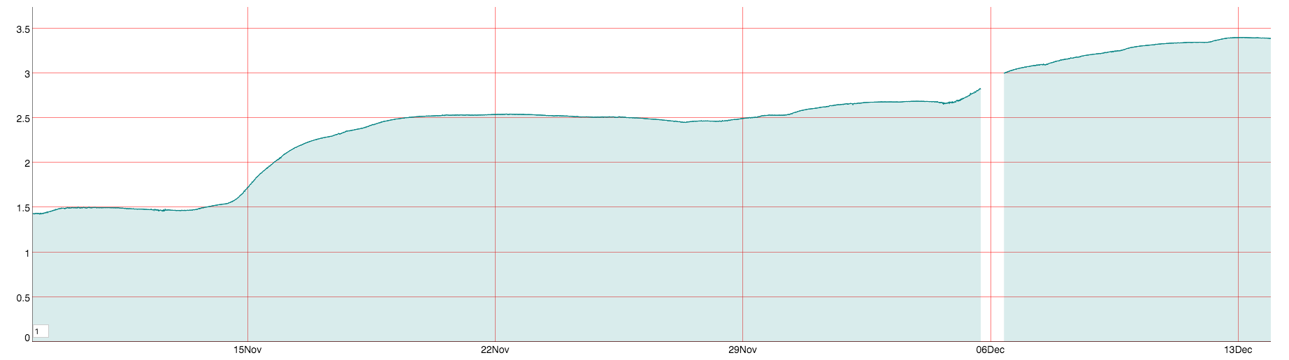
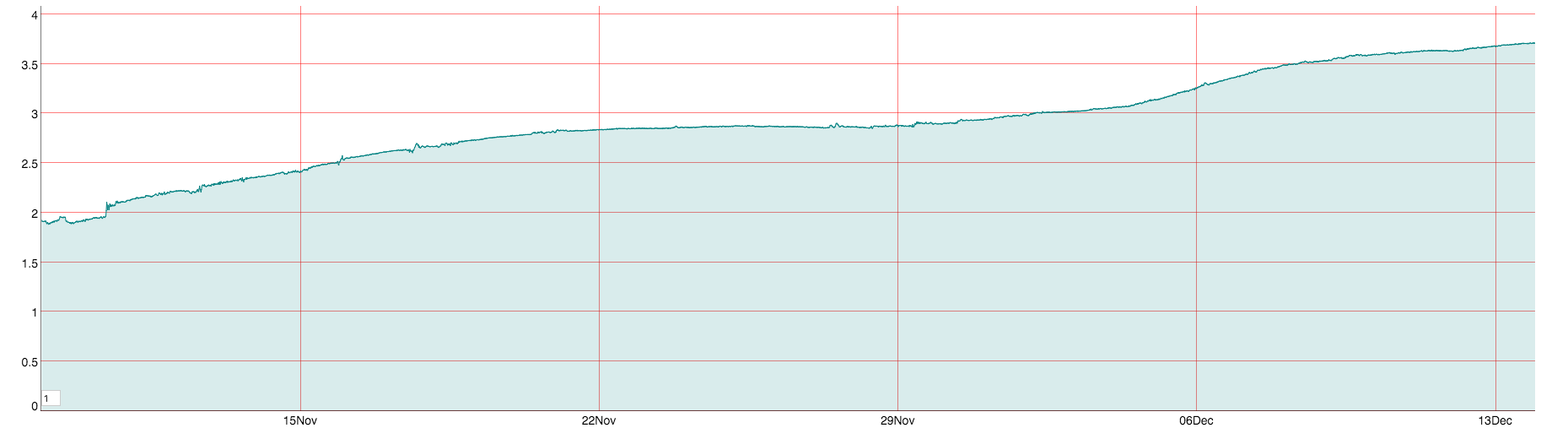
I had planned to write about what might be causing the flooding (apart from the rain, obviously), but it turns out that I did – the last time it happened in 2009. Not much has happened since. The various farming organisations have been calling for a national water management agency. They should be careful for what they wish for. No amount of dredging or deepening of the Shannon is going to solve the flooding problem – all that will happen is that the water will arrive faster in the areas that it will flood anyway. The Shannon flows through a series of towns, from Carrick-on-Shannon through Athlone on the way down to Clare and Limerick, and all of the water has to get through those towns one way or the other. The following graphs are screenshots from the excellent WaterLevels.ie website, which shows the status of water gauges around the country.
Water level rise of Shannon (in metres) in Carrick-on-Shannon, Co. Leitrim.
Note that the surge is beginning to decrease over the last day. Unfortunately, that surge is yet to arrive in Athlone, further downstream (see graph below)
Water level rise of Shannon (in metres) in Athlone, Co. Westmeath.
Both Athlone and Carrick have seen a great deal of construction during the Celtic Tiger years on land that had been previously floodplains. Rezoning land doesn’t make it higher, or drier. The only way to prevent some of these building from being flooded is to either demolish them, spend a fortune on flood defences to protect them or convert farmland back into flood-plains again, to slow down the flow of water through the Shannon basin (where most of the flooding has occurred). Not sure if the farmers will like that last option.
A slideshow of images of the flooding in Athlone.